Nevada State Parks, Part 5
September-October 2017
Nevada State Parks: Something for Everyone
PART 5: LYON, AND CHURCHILL, AND PERSHING…OH MY.
BY MEGG MUELLER
While it may not be a solely Nevada trait, the mercurial nature of our weather can truly shift our state parks year to year. Exquisite landscapes are abundant, but the viability of those landscapes is dependent, as we all are, upon water. Even the parks and sites that don’t include major water features can be tested in a drought year, as sand and brush become the dominant image, attempting to surpass the historical or geographical beauty of the park.
As previously mentioned our banner winter has left its mark on all our state parks, and those of Lyon, Churchill, and Pershing counties are no exception. The massive amount of water can be seen and felt in the recreation opportunities, and in the landscape.
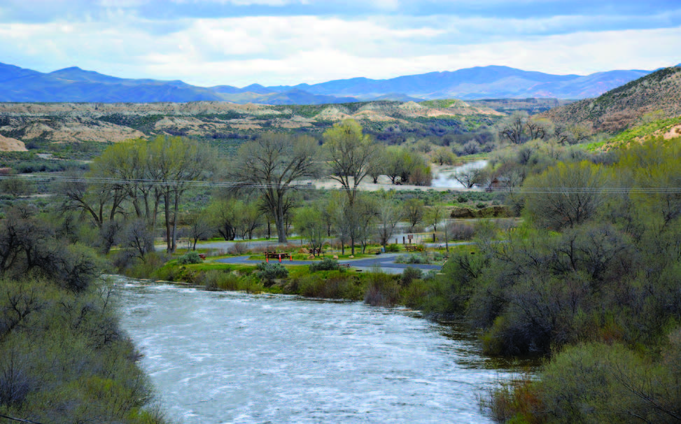
DAYTON STATE PARK
Dayton State Park’s 160 acres are perfectly situated in one of Nevada’s oldest settlements, but it does seem to have a little location confusion. The park lives on both sides of Highway 50, and while it was once right on the Carson River, the flood of 1997 shifted the river’s banks to the east away from the park.
On the west side of Highway 50 you’ll find the remains of Rock Point Mill, which was built in 1861 to process ore from the nearby Comstock Lode. The main park is on the east side of the highway, and here you’ll find 10 campsites large enough to accommodate 34-foot long RVs, a beautiful park area with group- use facilities, and two trails. One trail wanders along the Carson River, the other goes under the highway to the mill ruins.
The park was established in 1977, but construction on facilities wasn’t completed until 1979 when the park opened. Today, it’s a gathering place for families and groups looking for a place to play amid the myriad cottonwood and willow trees.
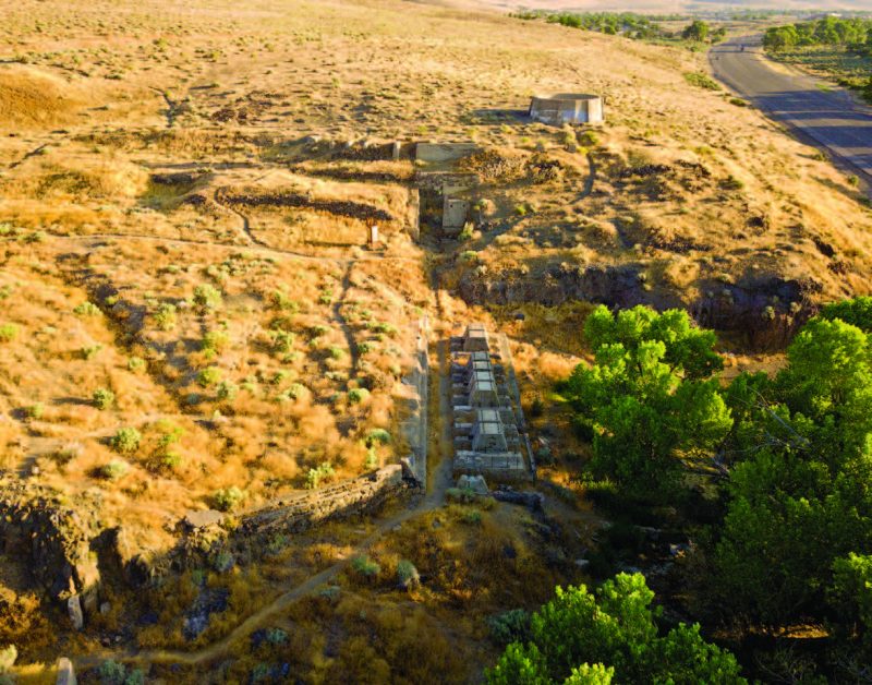
FORT CHURCHILL STATE HISTORIC PARK
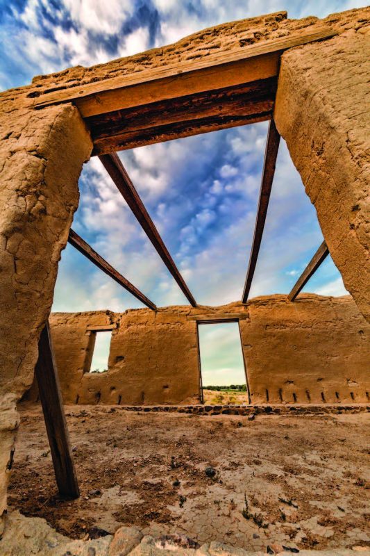
Just 35 minutes from Dayton is Fort Churchill State Historic Park, the state’s second park centered around a military fort (Old Las Vegas Mormon Fort is the other). Fort Churchill was built in 1860—Nevada’s first military outpost—for settler protection, and to guard the Pony Express mail riders and runs. The fort was in use for nine years, after which it was abandoned and the buildings sold at auction. Various periods saw the park sit in disrepair, but in 1957 it became a state park, and now remains in a state of arrested decay, ready to fascinate and educate all lucky enough to visit.
Whether camping in one of the 20 sites or visiting for the day, your trip should start at the visitor’s center and museum. Along with explaining what the remaining 15 structures were once used for, visitors can learn about the soldiers that called the fort home and what life was like during their tenure. A self-guided path (wide and well graded) wanders through the adobe structures and you can drive to two different access points, making the park very friendly for those with limited mobility. Buckland Station—situated just past the park entrance on Highway 95A—is worth a stop, also. Samuel Buckland purchased the buildings of Fort Churchill in 1869, adding them to his ranch holdings. The Overland Stage and the Pony Express both used the ranch as a stop. In 1997, the 19-room house and surrounding land was sold to the state and became a part of the park’s system. The home was renovated in 1999 and today, visitors can take a self-guided tour.
FORT CHURCHILL STATE HISTORIC PARK
10000 Highway 95A Silver Springs, NV 89429
parks.nv.gov, 775-577-2345
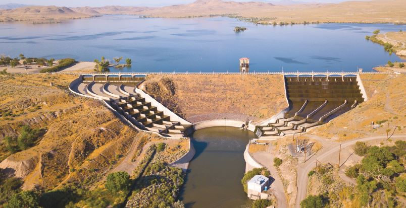
RYE PATCH STATE RECREATION AREA
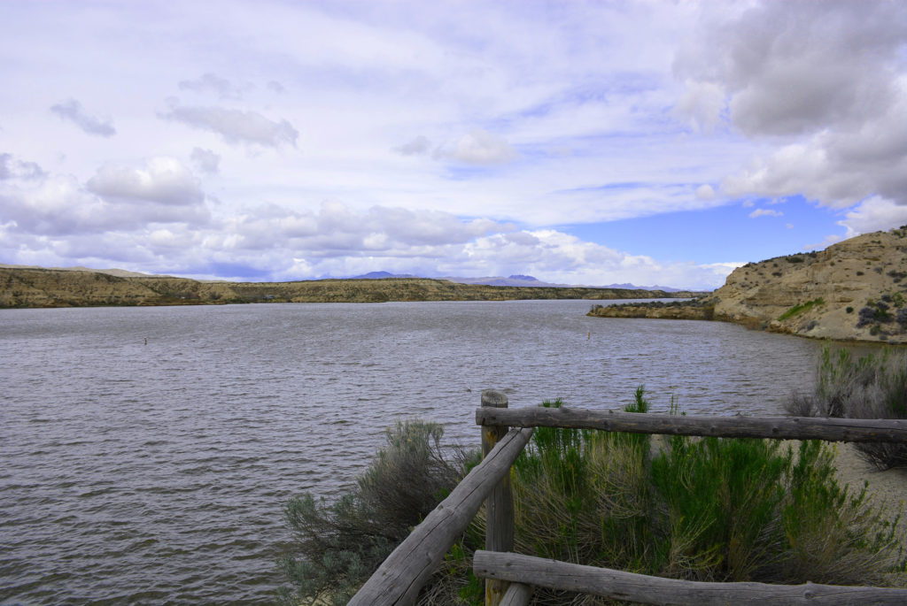
Rye Patch State Recreation Area is the sole state park in Pershing County, but this beauty can hold its own. Established in 1971, the focus of the park is the reservoir, which stretches 22 miles across the recreation area, and hosts a whopping 72 miles of shoreline. If you’re a state park aficionado—because you read our yearlong series—those dimensions might seem a bit familiar. Yep, the reservoir has the same length and miles of shoreline as that other jewel, Lake Tahoe.
While the similarities to that alpine lake may end there, the amount of fun to be had is pretty close. Thanks to record precipitation this year, Rye Patch is full of water so swimmers, fisherman, water skiers, and boaters can enjoy the splashy splendor of this oasis in the desert.
The Rye Patch Dam was built in 1936 to provide irrigation and control flooding in the area. Pershing County controlled the area until it was transferred to the state. Today, the park has two campgrounds with 47 sites and two day-use picnic areas. A boat launch on the west side supports the abundant fishing that is available year-round. Fish to be found include crappie, wipers (a cross between a white bass and a striped bass), white bass, channel catfish, black bass, and walleye. Three short hiking trails showcase some of the shoreline beauty.
RYE PATCH STATE RECREATION AREA
2505 Rye Patch Reservoir Rd. Lovelock, NV 89419
parks.nv.gov, 775-538-7321
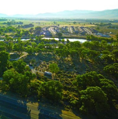
LAHONTAN STATE RECREATION AREA
Lahontan State Recreation Area, like Rye Patch, has suffered in recent years from the drought that touched much of the west. Just last year there was barely enough water to wade in, but that’s not the case this year. The spillway at Lahontan Dam is surging with water, and so is attendance at the lake. While named for the ancient waters that once covered much of Nevada, Lahontan Dam and reservoir were actually created from the Newlands Project, which in 1905, became the first Bureau of Reclamation irrigation project to deliver water. The Truckee and Carson Rivers were diverted to irrigate nearby Fallon and the rest is state park history. Another similarity to Rye Patch, Lahontan became a state recreation area in 1971. Unlike Rye Patch, however, most of Lahontan’s 69 acres of shoreline are accessible and ready for primitive camping and day use.
Lahontan is one of northern Nevada’s most popular places for boating and watersports, along with camping and day visits to the beach. There is just one developed campground, with on-beach camping allowed everywhere but the two day-use spots and boat ramp area. Fishing for walleye, white bass, hybrid wiper, catfish, trout, and other game fish is strictly catch-and-release, and hunting is allowed but only in designated areas. The lake is practically surrounded by giant cottonwood trees, which provide sought-after shade for campsites along with a nesting ground for bald eagles.

LAHONTAN STATE RECREATION AREA
16799 Lahontan Dam Rd. Fallon, NV 89406
parks.nv.gov, 775-867-3500
get it stamped!
Park Passport provides a free annual pass to all Nevada’s parks. The Nevada State Parks Passport Program aims to encourage Nevada residents and visitors to experience the diverse natural, cultural and recreational resources that span Nevada’s state parks. The booklet—which can be picked up at any state park—serves as a travel aid as well as a travelogue for park visitors and includes photos, a description of each park, lists of amenities, travel journal pages, and spaces for validation stamps that have been designed to reflect each park. Once passport holders have their booklets stamped at 15 different parks, they will earn one free annual pass to all Nevada State Parks. Call 775-684-2770 for more information or to have a passport mailed to you.