Trails For All
January – February 2017
NO LIMITS
NEVADA’S OUTDOOR SPLENDOR CAN BE ENJOYED BY EVERYONE, EVEN THOSE WITH LIMITED MOBILITY.
BY BRETT FISHER
There was a time when I thought much of Nevada was beyond my reach. Experiencing spastic muscles in my legs and reduced mobility, I was diagnosed with Primary Lateral Sclerosis (PLS), an upper motor neuron disease affecting muscles primarily in the lower body. A non-terminal cousin to Amyotrophic Lateral Sclerosis—better known as Lou Gehrig’s Disease—PLS is a permanent, often progressive condition that can change a person’s game plan considerably. I assumed this meant I had to give up outdoor recreation.
After doing some research, I discovered that accommodations had been made to several Nevada destinations so that people with disabilities could share in our state’s natural wonders. Innovative thinkers over the years have applied what they’ve learned from the Americans with Disabilities Act (ADA), designing wider, flatter trails to be accessible by all. There are more benches and rest areas along trails, surface dirt that’s packed and graded for better traction, pavement, and even raised boardwalks. These accommodations, remarkably, do not impede or take away from the natural environment. But they do make it easier for people like me to experience the outdoors.
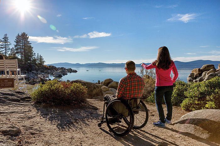
SAND HARBOR, LAKE TAHOE STATE PARK
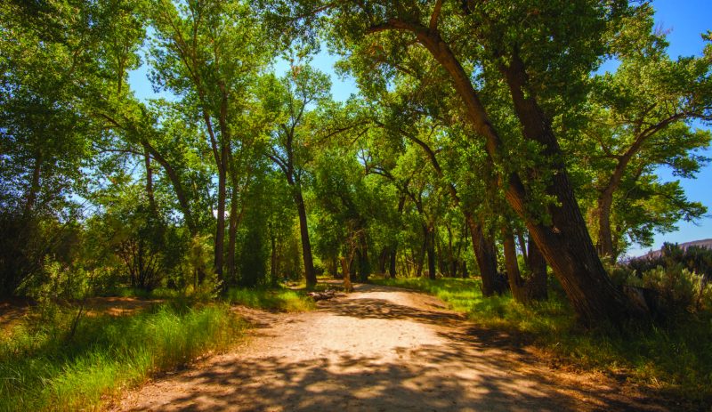
 On the northeast shore of Lake Tahoe—located along State Route 28—sits Sand Harbor, the crown jewel of Nevada’s Lake Tahoe State Park system that stretches much the length of the east shore from Incline Village to Zephyr Cove. Here you’ll find the collision of lakeshore and mountain topography, where loose sandy beach meets rocky terrain. A popular destination all year, Sand Harbor attracts thousands to its soft beaches, cold crystal clear waters, pedestrian-friendly boardwalks, as well as the annual Lake Tahoe Shakespeare Festival’s outdoor stage, which is lit up with live performances every summer. The draw for me, though, is the picturesque beauty of beach combined with towering Ponderosa and Jeffrey pines, age-old giant boulders crowding the shoreline and, of course, Lake Tahoe.
Viewing platforms are found at a few points along the boardwalk to ensure the most sweeping, panoramic vistas of one of the world’s largest alpine lakes. The boardwalk is level, making it easy to maneuver in a wheelchair or walker. A bonus to Sand Harbor is its beach access. Not only was I able to view the beach, but also could just about walk to the water’s edge and dip my toes in.
A heavy-duty waterproof mat runner connects the paved walking path paralleling the beach to the lifeguard station and the soft sands surrounding it. The Nevada Division of State Parks invested in two beach wheelchairs specially designed and built for mobility on the sand. Paid for with funds generated from the Lake Tahoe Nevada License Plate campaign, the wheelchairs are surprisingly sturdy given their lightweight design. Constructed of PVC pipe and equipped with four thick inflatable rubber tires that look like beach balls with bearings, the beach wheelchair maneuvers nimbly over Sand Harbor’s soft surface. The wheelchairs are free on a first-come, first- served basis by visiting Sand Harbor’s main office.
The best time to visit Sand Harbor is in the off-seasons— spring and fall. If you choose to visit during the summer, however, be prepared to go early in the morning to beat the crowds. Sand Harbor parking typically fills up by 10 a.m. on an average summer day.
SPOONER LAKE
A few miles southeast of Sand Harbor, at the junction of S.R. 28 and Highway 50, rests Spooner Lake, a delightfully quaint alpine recreation area small enough to hike around without too much trouble. The challenge for hikers with disabilities, though, is getting down to the lake from the parking lot. A moderate grade from the day-use area to the lakeshore is close to a couple hundred feet long and can be difficult to negotiate alone. Consider asking the park official for vehicle clearance down to the lake. A service gate to the north of the entrance is usually closed to traffic, but it’s often opened for vehicles with permission from Nevada State Parks.
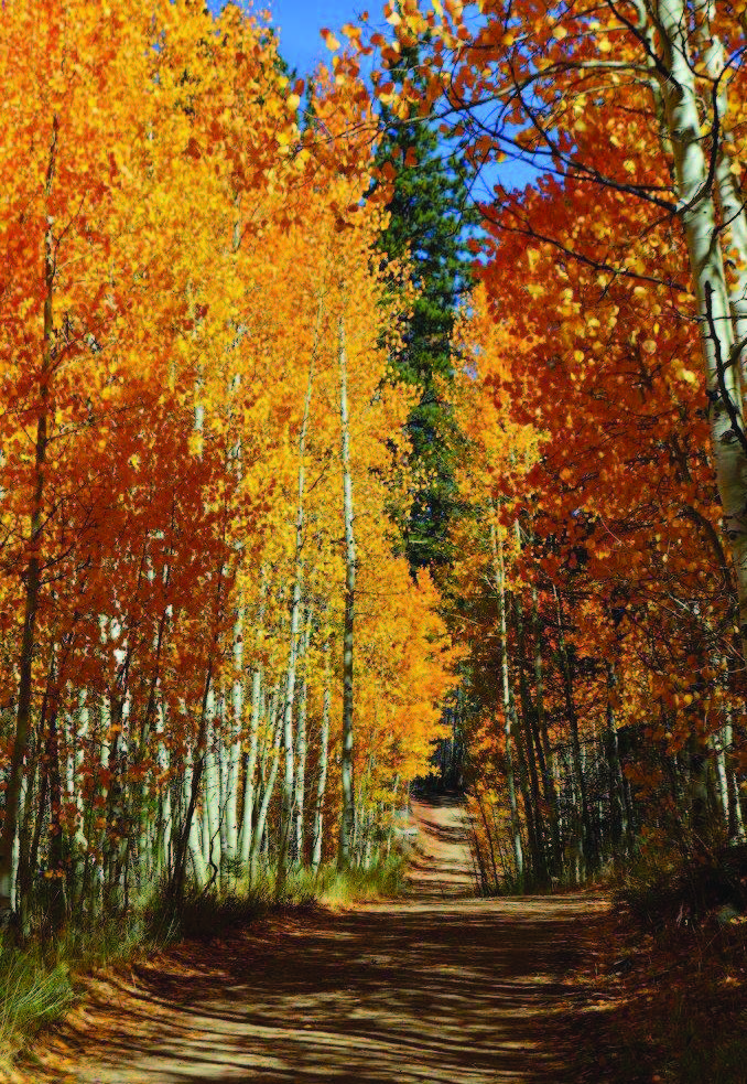
Once at lake level, you can choose to proceed toward the shore of Spooner Lake or head east up a service road toward Marlette Lake. The latter is about 4 miles above Spooner Lake, so it eventually climbs steeply. But the first three-quarters of a mile is flat and easy, passing by an expansive meadow and an old rancher’s cabin on its way through thick groves of aspen and crossing a small creek before the road comes to a T intersection where it begins to climb sharply, one side in the direction of Marlette Lake. I advise stopping at the T and turning around.
There’s still Spooner Lake to see, after all. The small lake offers a 2-mile loop trail that is generally maneuverable for wheelchairs and walkers, although be vigilant for errant rocks and tree roots breaching the trail’s surface. They can make the going a bit rough in places, but the trip is worth it. The trail is otherwise mostly flat and certainly wide enough for my rollator walker or a wheelchair.
Soil down near the lake shore can be much softer than the main trail, so traction can get more difficult the closer you venture to the water. Make the effort anyway just to see the large boulders situated on the northeast corner of Spooner Lake. This is a historic site, after all, featuring man-made mortars carved out of the rocks by American Indians, who once used them for crushing pine nuts.
Spooner Lake is usually full of waterfowl—Canadian geese and an assortment of ducks—while the shoreline is home to small mammals and several species of birds.
TAHOE MEADOWS
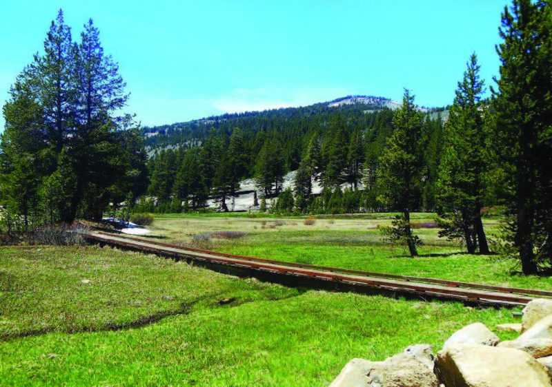
Soaring more than 2,000 feet above Lake Tahoe is Mount Rose Summit on S.R. 431, the highest mountain pass in Nevada at about 8,900 feet above sea level. Just below that—situated at around 8,700 feet elevation—is Tahoe Meadows, a U.S. Forest Service trail system that cuts gently through high alpine and timberline habitats.
Broad, expansive alpine meadows are the signature features of this destination, displaying brilliant wildflowers in the spring and robust greenery during the summer months. The east end of the upper meadow features ponds and marshes created from snowmelt and spring run-off. There are even small fish swimming in the little brooks that feed into the meadow marshes.
Tahoe Meadows is an ideal outdoor destination to escape the summertime heat. But don’t let its considerably cooler climate deceive you. Sunlight is very intense there, so be sure to protect yourself with sunscreen and headwear.
Wildlife, though plentiful, seems scarce and skittish. Hikers are met with the sounds of wildlife, but not so much the sights. The pine and fir trees at this altitude are generally smaller and shorter than at lower elevations. Vegetation is hardier, too. It has to be to survive cold temperatures, punishing winds, and very short growing seasons.

The trail—high in the rugged Carson Mountain Range, just east of the mighty Sierra Nevada—has wide, flat paths and friendly raised boardwalks crossing the meadows, but it’s not officially accessible. According to Chris Binder of the Tahoe Rim Trail Association, there are a few hundred yards of the trail not built or maintained to the accessible standards. Wheelchairs can access parking but may face some difficulty getting to the hundreds of feet of wooden boardwalks that stretch across the lower meadow. For those not in a wheelchair, there are several wood-planked footbridges on the upper meadow loop trail, an easy 1.2-mile excursion encircling the far eastern end of Tahoe Meadows.
It’s also good to note that visiting in the spring might bring challenges of late-season snowmelt blocking parts of the trail.
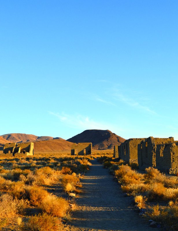
FORT CHURCHILL STATE PARK
Dropping significantly in elevation—at a point much further east beyond the Pine Nut Mountain Range—lay the ruins of historic Fort Churchill, a 19th century U.S. Army installation that’s now part of the Nevada State Parks system. Visitors here are treated to the vast expanse of the Great Basin’s high desert landscape, as well as a riparian habitat along the Carson River. The Nevada Division of State Parks has done exceptional work not only preserving the adobe ruins at Fort Churchill, but also maintaining a very user-friendly trail system around the archaeological area.
Though not especially wide, trails around the ruins are broad enough for a walker or wheelchair, which can maneuver easily over a flat surface of packed sand and fine pebbles. The trails are well defined, too, with rock borders and signs advising users to stay on marked paths. Other signs along the trails warn of rattlesnakes, just in case anyone needed a good reason to follow the rules. Daytime hikers are offered no shade at the ruins site, so either dress appropriately or else avoid visiting during the heat of the day.
The Carson River is very close by, though, and day-use campgrounds on park property provide plenty of cool shelter from the intense Nevada sun. To get there from points north, take U.S. Highway 95 Alternate out of Silver Springs and drive south toward Yerington. Look for signs to Fort Churchill State Park, which will be on the right. If you pass over the railroad crossing on the highway, then you’ve gone too far.
OXBOW NATURE STUDY AREA
 Most universal access trails in northwestern Nevada are found in riparian zones, areas where land and water bodies come together. One reason is because designing trails for assistive-device use is easier in areas that are already broad and flat to begin with.
In Reno, the Oxbow Nature Study Area west of downtown off Second Street is a refreshing distraction from big city life. This Truckee River riparian corridor, managed under a public partnership between the Nevada Department of Wildlife and the City of Reno, is teeming with abundant plant and animal life. Dense foliage and underbrush provide adequate shelter for many animals, ranging from waterfowl and other birds to mammals both small and large.
The Truckee River features areas of whitewater rapids and calm water along this corridor, treating visitors to the sounds of a rushing river and a sleepy tributary all at once.
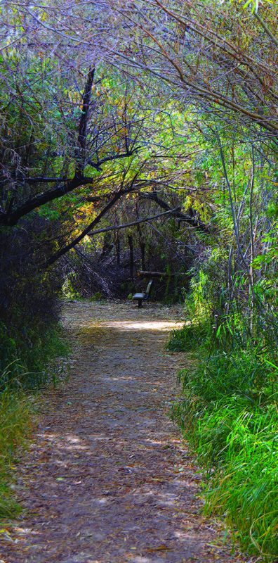
Oxbow’s nature trail, less than a half-mile long, is ideally suited for wheelchairs and walkers. Broad, flat and firm, the path is wide enough to accommodate two devices passing one another. There is also more than adequate shade from the sun here as foliage has grown up and over the path, forming natural arches in some places that give one the feeling of hiking through a storybook.
To get there, follow Second Street west from downtown Reno until it becomes Dickerson Road, which then dead-ends into the Oxbow Nature Study Area.
CARSON RIVER RIPARIAN CORRIDOR
Twenty-five miles south of Reno is Carson City, Nevada’s state capital and home to a trail system friendly to people with disabilities along the Carson River riparian corridor. Riverview Park at the end of East Fifth Street and Carson River Park at Silver Saddle Ranch off Carson River Road serve as trailheads to paths that offer easy, scenic nature hikes for people with disabilities. Trails are wide, flat, and packed down for good traction.
Mighty, mature cottonwood trees line the Carson River’s banks, providing ample shade along the trails for hikers. These old-growth giants are also home to owls and hawks, a plethora of other birds, as well as small mammals. Raptors and herons have long frequented the area, while coyotes, mule deer, and even a band of wild horses call this habitat home.
From the I-580 freeway at Fairview Drive, follow Fairview east to the roundabout at East Fifth Street. To get to Riverview Park, just follow East Fifth until it ends at the Korean War Veterans Memorial. The park is right behind it.
Carson River Park at Silver Saddle Ranch is accessed by taking East Fifth Street to Carson River Road. Turn right and follow the road out to the park on the right, just before the bridge over the Carson River. While not every trail has accommodations for all types of disability, there are many that offer some sort of accessibility. Check with local parks and management agencies before you head out. There are no limits to the beauty of Nevada’s wilderness, and for those with limited mobility, seeing it first-hand is getting easier.
TRAILS FOR ALL
traillink.com
accessiblenature.info
parks.nv.gov
ndow.org
fs.uda.gov/ltbmu