The Loneliest Road In America Comes Of Age
January – February 2016
The Loneliest Road In America Comes Of Age
30 YEARS AGO, A DUBIOUS DISTINCTION BEGAT A FORTUITOUS FACT.
BY MARILYN NEWTON
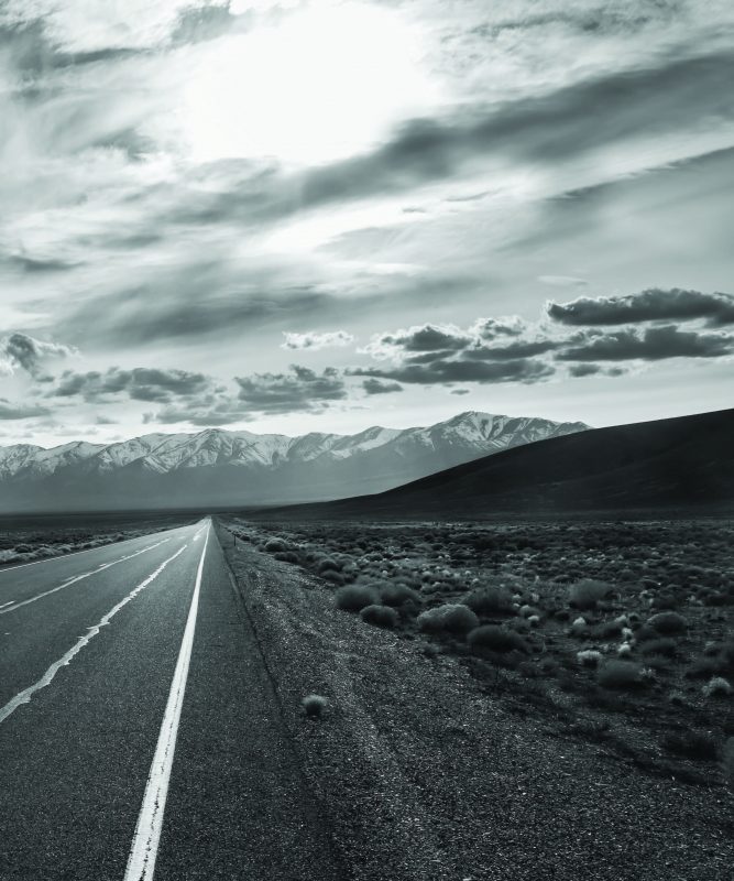 It was 30 years ago, in July 1986, that Life magazine used the term “The Loneliest Road in America” to describe the stretch of U.S. Route 50—more commonly known as Highway 50—from Fernley to Ely across central Nevada. AAA even advised against traveling the highway, claiming there was nothing to see. For those who were crazy enough to travel that lonely road anyway, they were advised to carry survival gear such as water and cold-weather clothes. Is the Loneliest Road in America really as bad as Life magazine claimed?
The moniker could easily have been a slap in face, but savvy state officials adopted the phrase and turned it into something positive. The state created a survival passport that same year, which travelers could get stamped at locations along Highway 50 and redeem for a certificate. Suddenly, the loneliest road wasn’t so lonely as people sought bragging rights to “I Survived the Loneliest Road in America.”
Tourism numbers began to climb and are continuing to do so, and the passport program continues to this day. The state’s response became a help to the economy of the towns along U.S. 50.
“The state turned lemons into lemonade,” Fallon City Councilman Bob Erickson says. “I think Highway 50 has a unique place in the country and Nevada history. It’s like going to a museum. I love the history of the communities and the wide open spaces.”
Wally Cuchine, who was in charge of Eureka’s opera house for more than 18 years, agrees.
“The survival passports are still bringing people to town,” Wally says.
A NOT-SO-LONELY HISTORY
The path of the Loneliest Road in America has been well traversed in Nevada’s history. American Indians followed herds of antelope and deer across the middle of what would become Highway 50. Early explorers— including Jedediah Smith and John C. Fremont—traveled through the area; the Overland Stage followed a similar route, as did the Pony Express carriers. In 1913, entrepreneur Carl G. Fisher dreamed of building a continuous roadway from New York City to San Francisco as a memorial to President Abraham Lincoln. What became the Lincoln Highway bisected Nevada’s core, but was described by a young Dwight Eisenhower as “…one succession of dust, ruts, pits, and holes.”
It wasn’t until 1926 that a national highway system was created, and present-day Highway 50 closely mimics the Lincoln Highway in many places. Nevada’s portion of the bicoastal road traverses the state for a distance of about 410 miles, starting in South Lake Tahoe and ending at the Utah border. The 287 miles from Fernley to Ely is the designated Loneliest Road, even though the section between Fernley and Fallon is actually Highway 50 alternate.
A FEAST FOR THE SOUL
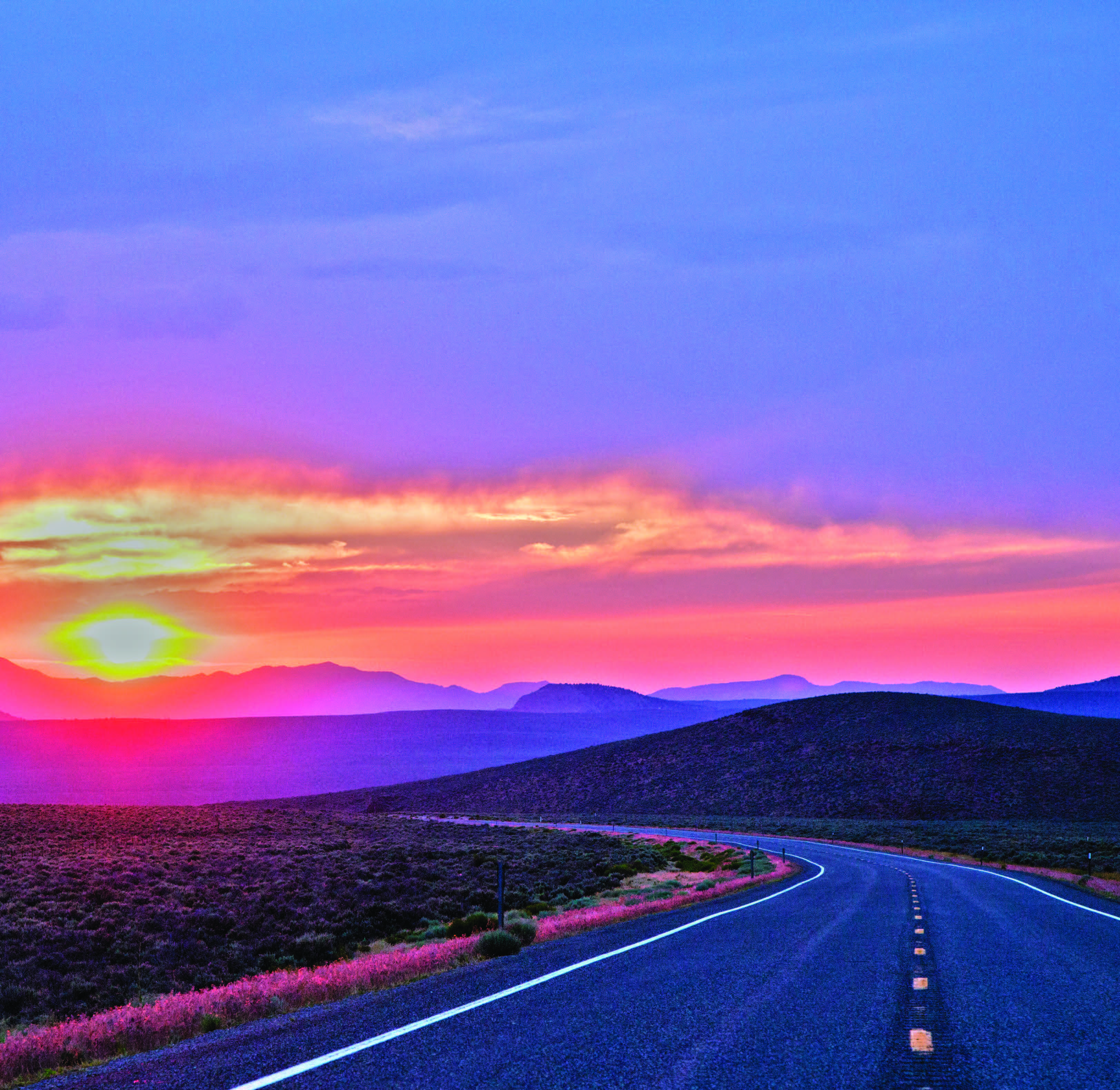
The many mountain ranges—about 17—in those approximately 287 miles take travelers from the serene desert floors to majestic mountain ranges, with unparalleled vistas at every turn. Despite the naysayers 30 years ago, there is plenty to see and do along the loneliest road, and short side-trips reveal a lot about Nevada. But it is also clear why it was so named; five towns span the almost 300 miles and while the population of Fernley is about 19,000, the remaining four—Fallon, Austin, Eureka, and Ely—add just another 13,000 citizens, combined.
It is at Fernley—which is technically on Highway 50 Alternate— the Loneliest Road begins and the distance between towns grows and grows. Yet it’s what’s in between and around civilization that also makes Highway 50 worth a trip.
FERNLEY
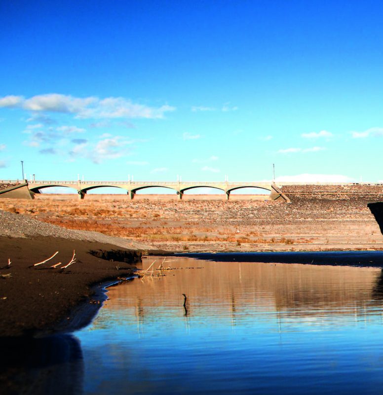
A farming community established in 1904, Fernley was also a depot of the Southern Pacific Railroad. Today, the town of nearly 20,000 sits at the apex of Highway 50, Interstate 80, and U.S. Route 95 Alternate. Hazen is a small hamlet just 12 miles east of Fernley, and while the town’s store is on the National Register of Historic Places, it is closed but worth a photo. The town is also the location of Nevada’s last lynching in 1905. Just off Highway 50 on U.S. 95 Alternate is the Lahontan Reservoir. Named after the ancient Lake Lahontan, this local boating and camping area offers 69 miles of shoreline and ample wildlife viewing opportunities, including bald eagles.
FALLON
From Fernley, it is 30 miles to Fallon, which got its start in the 1890s when the Truckee River’s waters were brought to the area and the desert was reclaimed for agriculture.
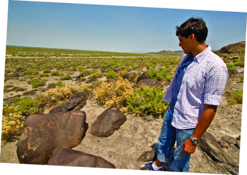
 About 7 miles outside Fallon, the road passes by Grimes Point Archeological Area. Ancient civilizations in the valley left their stories via petroglyphs now found on the basalt rocks there. Stop at the Churchill County Museum in Fallon for information about a tour of Grimes Point and nearby Hidden Cave. Past those petroglyphs—about 25 miles outside Fallon, 100 yards before Sand Mountain on the north side of Highway 50—the alkali lakebed serves as the graves of the LeBeau children. Widely believed to be the graves of three sisters that died en route via buckboard to a doctor too many miles away, the graves are tended by locals committed to preserving the memory of the many pioneers who died crossing the desert in the 1800s.
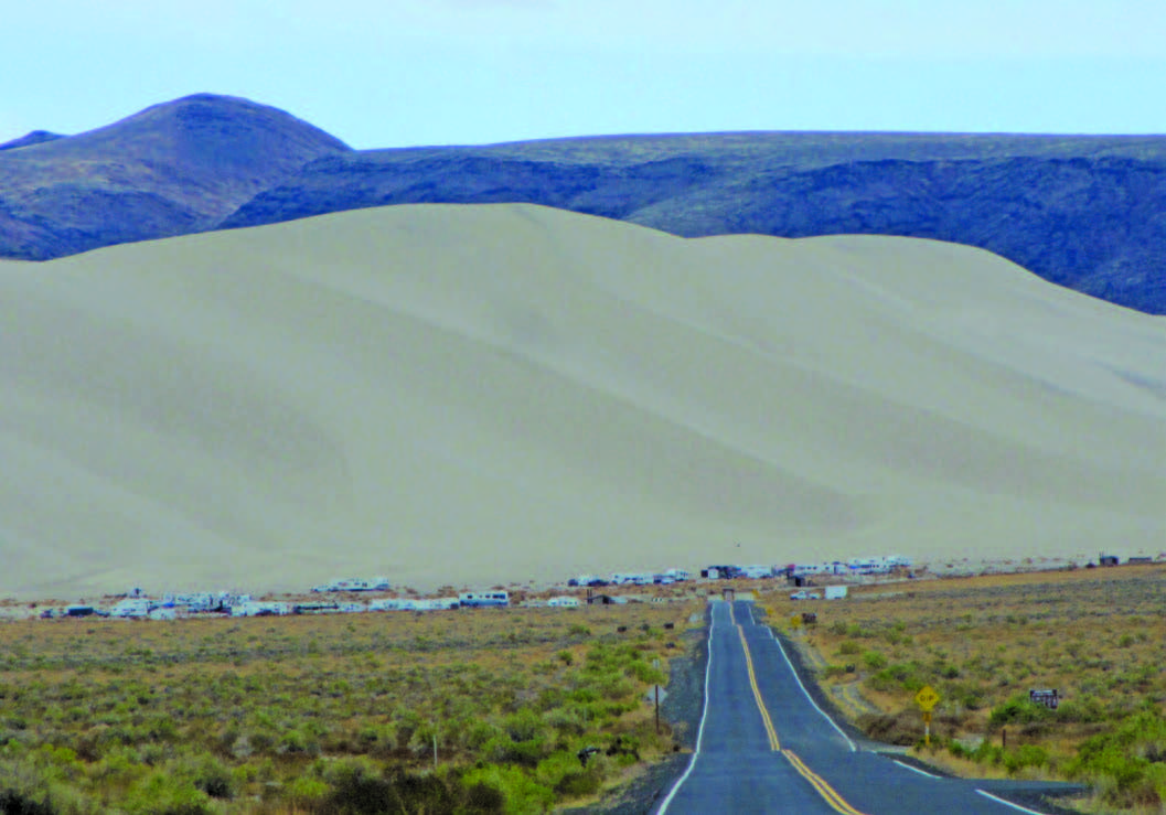
Next is Sand Mountain. Sands from ancient Lake Lahontan form the huge dune that is 2 miles long and 600 feet high, and popular for camping and off-road vehicle activity. The ruins of the Sand Springs Pony Express Station are nearby, and the fort is worth a stop.
The site of a 12.5-kiloton atomic bomb—Project Shoal—that was detonated underground in 1963 is found just over the Sand Springs mountain range for the very intrepid and patient explorer. Take State Route 839 and head south about 5 miles; take a right until a fork in the road and veer right. A concrete pad, and other debris are still on the site but visitors are advised not to touch anything.
A few miles east of Middlegate (see page 22), the Lincoln Highway, U.S. 50, and Pony Express routes diverge over and around the Desatoya Mountains. The Loneliest Road follows the route between the Desatoyas and Clan Alpine Range, where the ruins of the Cold Springs Pony Express Station can be found. Built in 1860 of large native rocks and mud, the building’s four rooms included living quarters, barn, storage, and corral.

AUSTIN
Between Fallon and Austin, it’s 110 lonely miles. About 5 miles before is a historical marker for the ghost town of Jacobsville; take the road there south of Highway 50 for just under a mile, then bear left for about a half mile. Building foundations still exist from the short-lived town. Continue on the road for a short distance to Ledlie, to see a few remnants of this old railroad stop.
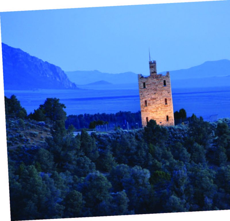
Just west of Austin is a castle built by Anson Phelps Stokes, a wealthy capitalist who had a financial interest in local mines. The three-story Stokes Castle is 50 feet by 50 feet around, and was occupied briefly in the late 1800s by Stokes and his sons.
Legend says Austin was founded by a Pony Express rider’s horse that kicked over a rock, revealing a rich ledge of silver ore. Another legend—completely true— is Reuel Colt Gridley’s Sanitary Sack of Flour, which was just that; an ordinary sack filled with flour. Selling the sack over and over, Gridley helped raise more than $275,000 for hospitals treating injured Civil War soldiers. Gridley’s store is still standing, and a historical marker is on the spot.
Hickison Petroglyph Recreation Area is 24 miles east of Austin, and offers a short self-guided tour past a number of American Indian petroglyph panels, plus camping and gorgeous views.
EUREKA

During the 70 miles to Eureka from Austin, you’ll drive just 14 miles north of the geographic center of Nevada, and understand Eureka’s importance in the middle of our state. To find it, about 37 miles east of Austin take State Route 882 south and look for a solitary post and geocache box.
The Friendliest Town on the Loneliest Road as it’s become known, Eureka was founded on silver discoveries in 1864, and the mining town is still a welcome respite along the trek. Its most famous feature is the Eureka Opera House, built in 1880, and the town boasts an impressive walking tour of its historic buildings. Eureka is also the perfect gateway to the ghost towns of Hamilton, Shermantown, Monte Cristo, Treasure City, and Eberhardt.
ELY
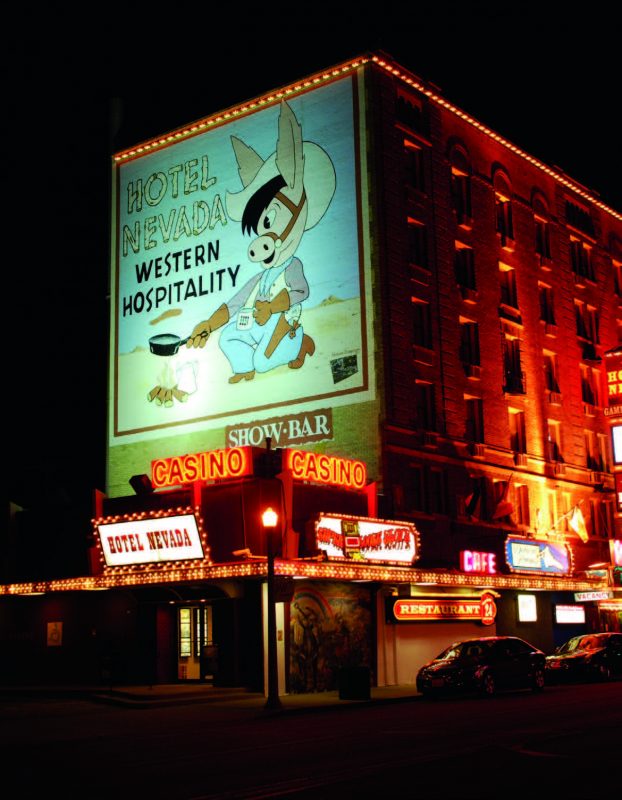
The Loneliest Road ends 77 miles past Eureka in Ely, which was originally a stagecoach station. The Pony Express also passed here, as did trains connecting the mines of Austin and Eureka to the Transcontinental Railroad. It wasn’t until after the start of the last century that a mining boom hit the area when copper was discovered. Although the railroads are gone now, the Nevada Northern Railway National Historic Landmark and its museum are a must when visiting this small town, as is its renaissance village that recreates the housing of Ely’s many founding immigrants.
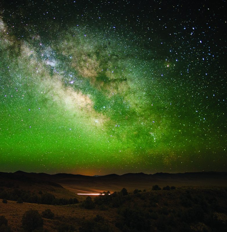
At the end of Highway 50 in Nevada is the state’s national park—Great Basin National Park. The park is also 30 years old this year; look for a full story in a future issue. The loneliest road is anything but lonely, depending on your spirit of adventure. The towns may be small but they are historic and offer interesting places to see.
HIT THE ROAD
Pony Express Territory
ponyexpressnevada.com