Odyssey Of A Ghost Town Explorer: Part 1
January – February 2016
Odyssey Of A Ghost Town Explorer
PART 1: SKELETONS OF HISTORY
BY ERIC CACHINERO
 Ghost towns are skeletons of history. Though time has withered many away to the point of almost nothingness, even the most seemingly inconsequential heap of rocks and sticks tells a story: stories of hardship, stories of hope, stories that only the people who once called these establishments home will ever know. But not all are withered away. Some leave clues behind in their architecture. Magnificent arches, stamp mills, even huts dug into the side of a mountain and reinforced with railroad ties all leave clues as to their purpose and inhabitants. Explorers of these sites have a unique opportunity to construct their own understanding of the goings-on of yesteryear, and with more than 600 ghost towns in Nevada, can spend some serious time doing so.
BLACK ROCK BOUND
 It is an especially chilly November morning when my grandfather, Paul McKee, and I set off in search of as many ghost towns as we can possibly jam-pack into a single day. Heading northeast out of Reno via State Route 447, we arrive in Gerlach—our final stop for fuel before heading east on Jungo Road (Secondary State Route 48). The road is about 100 miles of dirt (not counting side trips to ghost towns) and follows for some distance the Noble’s Cutoff of the California Trail, as evidenced by tracks visible from the main road.
Several natural hot springs are visible to the north of the Jungo Road—just on the edge of the Black Rock Desert—and offer a chance to warm up on freezing days such as this. We stray from the main road, following SSR 86 en route to our first ghost town of the day: Rabbithole Springs.
RABBITHOLE SPRINGS
 Discovered by the Applegate family in 1846, the springs—located on the Applegate-Lassen Route of the California Trail— provided the last source of water before the 21-mile trek across the Black Rock Desert. Though sporadic placer mining activity took place, it wasn’t until the 1930s that a washing plant was installed at the springs and as many as 150 men are said to have mined the area during its peak.
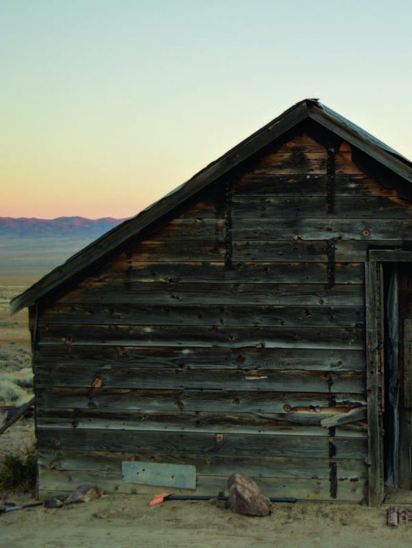
Today, the wash plant at the springs is still visible, along with a half-standing stone structure nearby. About 3.5 miles east and somewhat visible from the road lie several more structures, including an intact cabin whose door is branded appropriately: “The Rabbithole Resort.”
SCOSSA
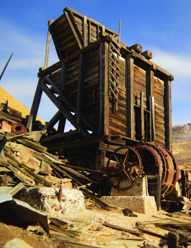
Some 12 miles east of Rabbithole Springs via SSR 86 lies the ghost town of Scossa. The establishment’s roots can be traced to March 1907, when small mining operations began. The boom was short-lived, however, and the town faded out as quickly as it had appeared. Then, in 1930, Charles and James Scossa established a claim on the site. In hopes of a stimulant to combat the Great Depression, the Saturday Evening Post published a feature article on the site, telling of the discovery of gold. Gold production ramped up over the next few years, with some even describing the location as the “only camp of immediate promise on the Nevada desert.” Though the metals provided by the region did help boost the state’s mining profits, gold recovery didn’t pan out much after 1937, and ushered the town into the ranks of ghost.
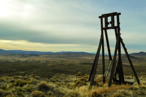
Several small structures remain where the townsite once stood. A large cross keeps watch over the dwindling structures, as does a large mine head frame and several mine openings above the town. Though the head frame can be approached, please keep your distance as the ground can be very unstable and a person falling straight down a 150-foot mine shaft may be pretty hard on the mine.
Back out on SSR 86 and heading north—about 2 miles north of Scossa—lies Maude’s Well. The site is visible from the road and holds the remains of an impressive stamp mill, used to crush gold- and silver-rich ore.
UNIDENTIFIED SITE
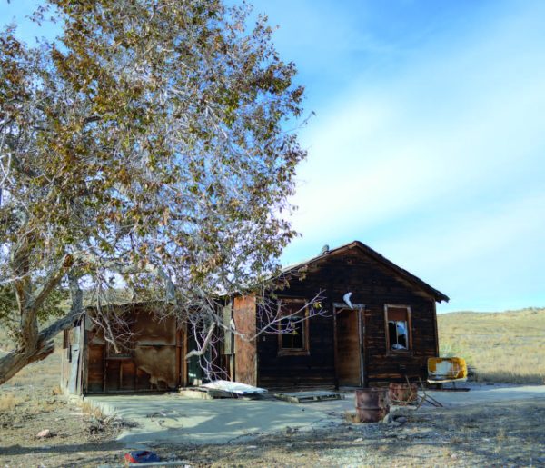
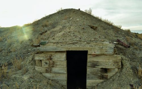 Driving back toward Rabbithole Springs, we spot a large pond on the north side of the road, with an unnamed road running alongside it and perpendicular to SSR 86. We decide the road is the most direct route to our next destination: the ghost town of Sulphur. Heading north on the unnamed road, we spot several interesting-looking huts off to our east. After exploring a bit, we quickly realize we have come across something special. Only in Nevada can you stumble upon an unknown, unmarked, and to my knowledge unnamed ghost town.
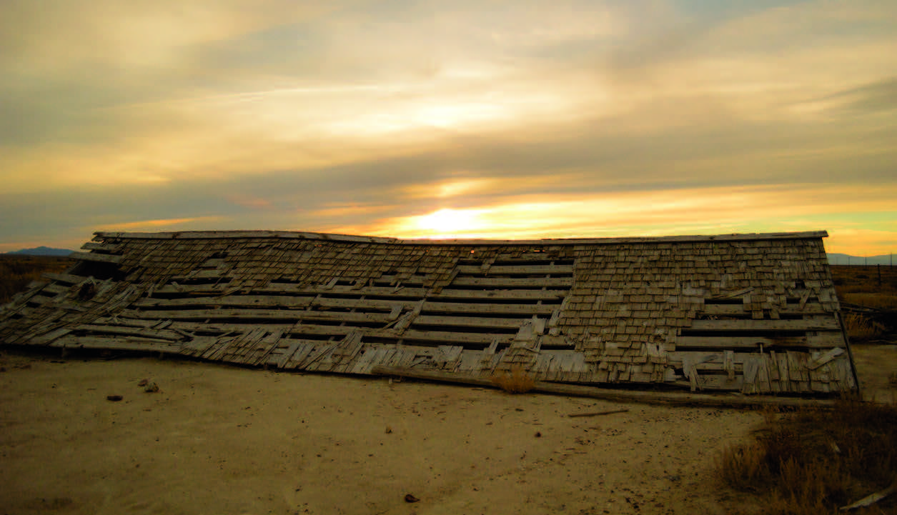
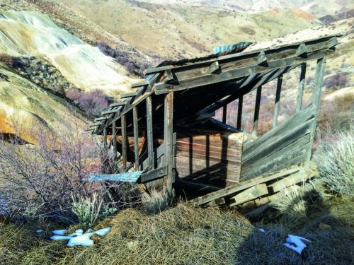
The settlement has approximately eight huts built into the side of small hills. Though some roofs are missing, the huts’ structural integrity is relatively sound. All except one: its walls—fashioned from used railroad ties—are caving under the enormous weight of the earth that surrounds it. As curious as the lack of information on this ghost town is the size of some of the doors and ceilings. They are such that anyone taller than about 5 foot 4 inches would be forced to duck to get inside them.
The sun begins to set as we get back to the truck, and we hurry along the unnamed road to our next ghost town.
SULPHUR
Sulphur is aptly named after the sulfur deposits that exist nearby. The deposits became a commodity when a Paiute Indian is said to have lead prospectors to the area in 1869. Quickly the claim began to pay out, and in the 1880s, the mine was producing six tons of sulfur per day. Once the Western Pacific Railway laid lines through the area in 1909, the settlement constructed a post office. It wasn’t until the 1950s that the post office closed and the town became a skeleton.
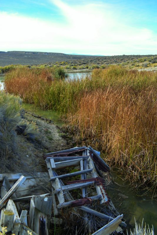
Today, not much remains of the town of Sulphur. There are several collapsed structures that dot the landscape, dwarfed by the massive Hycroft Mine, which operates in the area today.
WIN THE MUCCA
We begin to make our way to Winnemucca, where a delicious barbecue dinner at The Pig awaits us. As we drive, Pulpit Rock—a massive geological feature protruding straight up from the earth—is illuminated by the sun and makes for a wonderful view. We snap a few sunset photos and eventually retire for the night.
WELCOME TO PARADISE
 The next morning, we’re up and headed straight for paradise. Everyone has a different notion of their own paradise, but when it comes to the sheer beauty of rustic Paradise Valley, I’m sure many would agree it’s deserving of the title. Though far from a ghost town, Paradise Valley is a must see if you’re traveling in
this part of the state.
My grandfather and I try, albeit unsuccessfully, to locate several ghost towns in the area. Spotting mule deer while driving dirt roads looking for ghost towns isn’t a bad way to spend a day, though, even when unsuccessful.
We spend some time glancing at Hinkey Summit, which lies just north of Paradise Valley, and decide not to attempt passing it due to snowy conditions. So, it’s back out to Highway 95 north for us as we drive to more-accessible sites.
NATIONAL
 Near the Oregon border, we turn off on National Canyon Road (SSR 85) and make our way up the canyon. A large, rock house is visible at the mouth of the canyon, as is Threemile Creek, which winds across the dirt road a time or two. Soon we come across a structure used for loading ore at the Birthday Mine. The structure is massive and in incredible shape considering its age. We finally reach the top of the canyon, and can’t see much that resembles the ghost town of National anywhere. After glassing the area with binoculars, we decide to descend down SSR 694 by foot due to muddy road conditions. Soon enough, we discover the National site.
National is rumored to have once contained the richest gold ore ever mined in Ne- vada. In 1907, two prospectors are said to have entered the area by car—a car produced by National Motor Vehicle Company, hence the naming of the town. By 1909, the mine was producing ore that averaged almost $30 per pound. The ore was so rich that a town quickly sprung up, complete with several stores, saloons, and even a two-story hotel. By 1915, nearly $7 million in gold had been pulled from the ground, and the veins began to run dry.

Not much remains in the area today, surprising considering the town once contained more than 50 framed houses and many businesses. A flooded mine shaft accompanies several wooden and metal structures that exist sporadically throughout the canyon.
TUNNEL
 With one more ghost town on our list, we hurry to Lovelock—the fastest route for us to reach Seven Troughs. We take Seven Troughs Road (State Route 399) northwest out of Lovelock, racing the sun so we can see the ghost town in the last bit of daylight. As we approach Sage Valley hoping to make it to Seven Troughs, another ghost town catches our eye, and we decide to explore it instead. The ghost town of Tunnel is what we find, and what a beauty it is.
The site was established in the late 1920s when an attempt to tunnel horizontally into shafts of the Seven Troughs mines located several miles away was made. The goal was to eliminate drainage problems that were plaguing the Seven Troughs mines. After digging a little more than two miles, wet ground was encountered and drilling costs soared. All work was ceased in 1934.
There are several impressive structures still standing in Tunnel. A large, redbrick building stands in decent shape. A stamp mill, wooden cabins, and mine tailings create an impressive view. A cemetery lies about a mile below the camp with about a dozen gravesites, but the markers are illegible.
HOME, JAMES, AND DON’T SPARE THE HORSES
As my grandfather and I make the drive back to Reno, I reflect upon the things we experienced. It’s a wonder that these places endure. Endure through rain, through heat, through vandals leaving their ugly mark on the integrity of history; these places still exist. Some of these towns are fragile, as skeletons often are. But though delicate now, the impact they had on Nevada history is not.
Keep an eye on this column for the remainder of 2016 as we explore ghost towns all across the state. Have a ghost town you think we need to see? Email [email protected] and let us know about it.